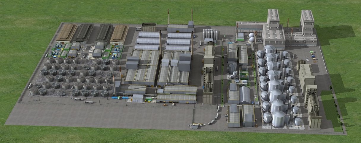
3D platform and C2 system - IGO
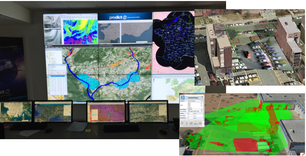
The 3D platform and its associated C2 allow to centralize and visualize all the information. This allows to asset the situation (consultation, decision and communication tools), and to organise an efficient intervention by piloting the subsystems:
- Define the implementation of the means on-site via the platform (inter-visibility studies etc.)
- 3D modelling of the site (indoor and outdoor mapping)*
- Access control and flow management, location of people and vehicles on the site
- Supervision via the 3D carto: federating smart sensors, SDI, integration of video-protection flows, radar and optronic data, etc.
- Real-time tactical situation awareness via 3D mapping
- Visualization clone/digital twin (for intervention preparation)
- Maintenance Assistance Tool
- Risk analysis tool
- Data processing (3D Mesh 3D models and CityGML structured models)
*Data acquisition by ALTAMETRIS with man-pack, UAV and/or helicopter (LiDAR, photogrammetry)